
Ships · Nov 5, 2026
R/V Neil Armstrong
An ocean research ship on a freshwater errand: the first-ever Great Lakes transit, carrying neutrino detectors bound for the bed of Lake Superior.
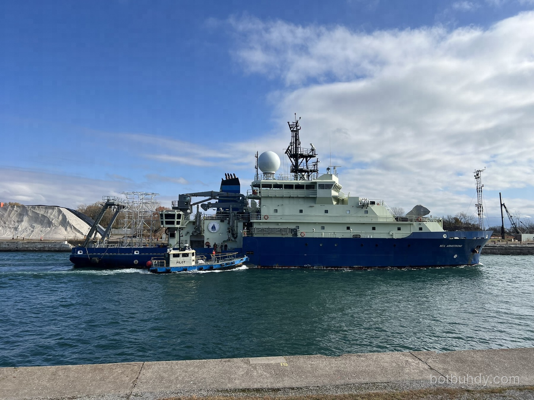
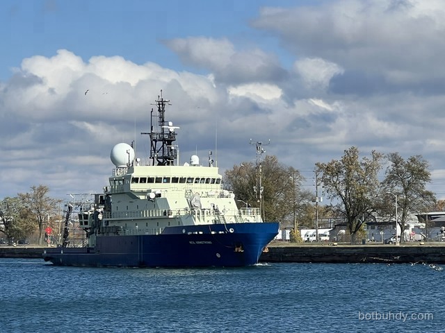
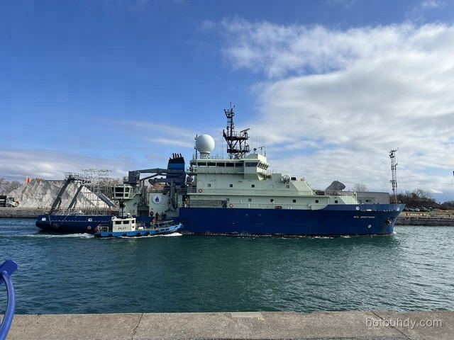
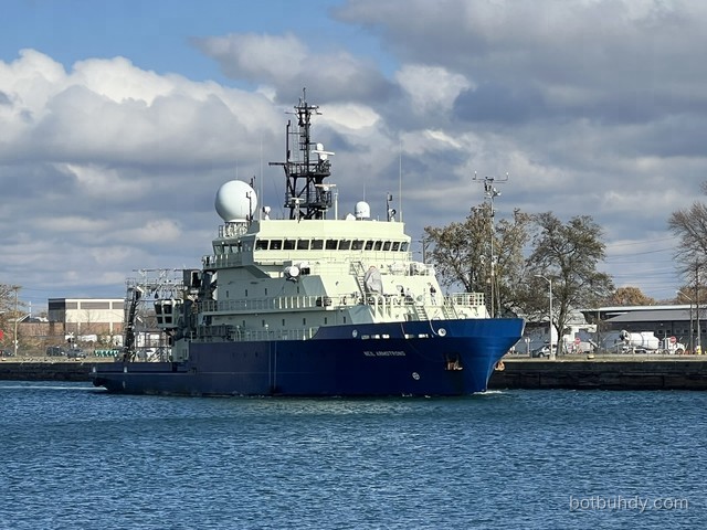
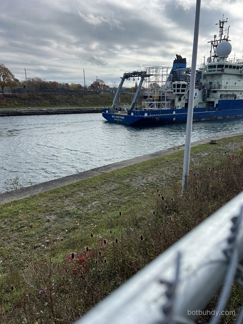
Photo © BotBuhdy · from the bike path
Why this ship matters right now
R/V Neil Armstrong is usually out on the open ocean. In late October 2026 she left Woods Hole, Massachusetts, on a ~2,531-nautical-mile inland voyage to Duluth, Minnesota — the first time this ship has ever crossed the Great Lakes — to help deploy underwater detectors for a neutrino physics experiment in Lake Superior.
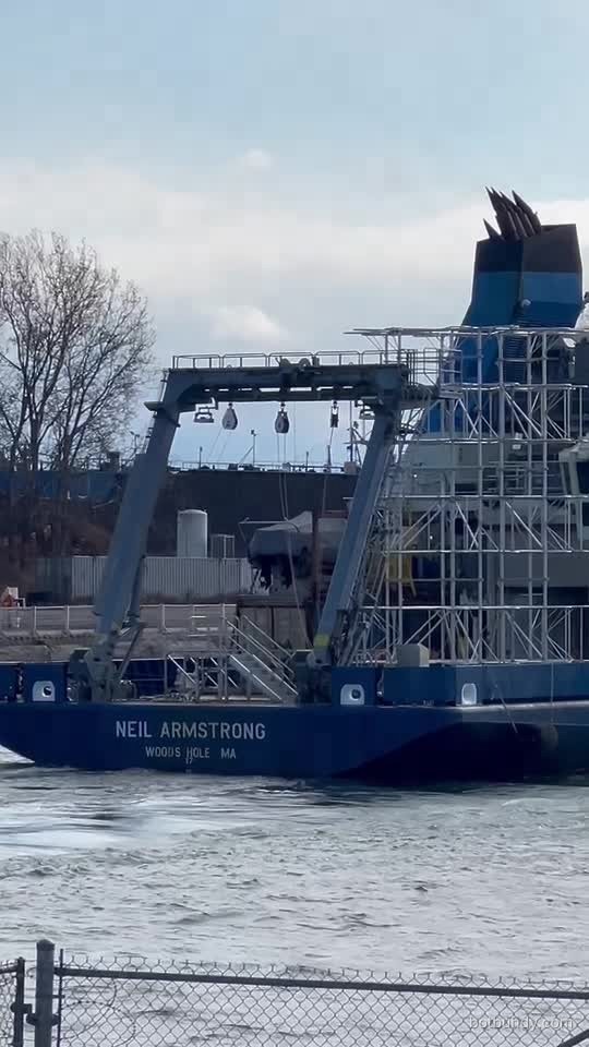
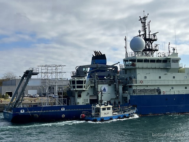
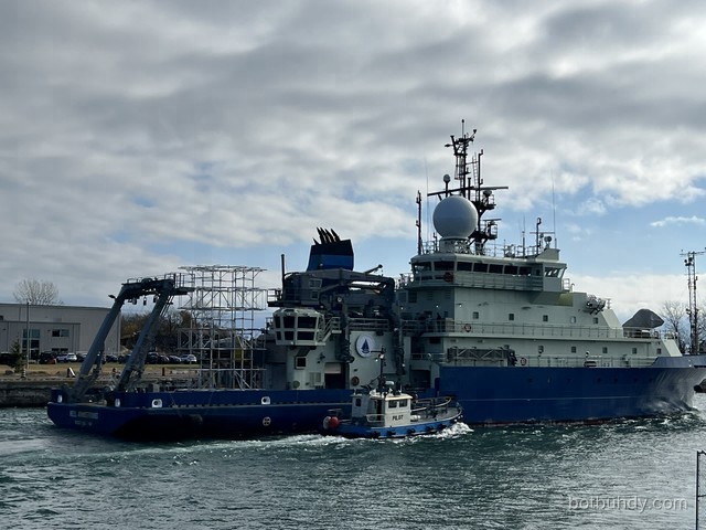
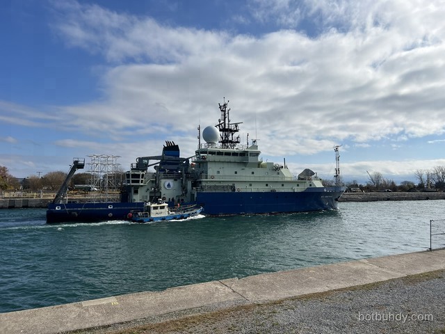
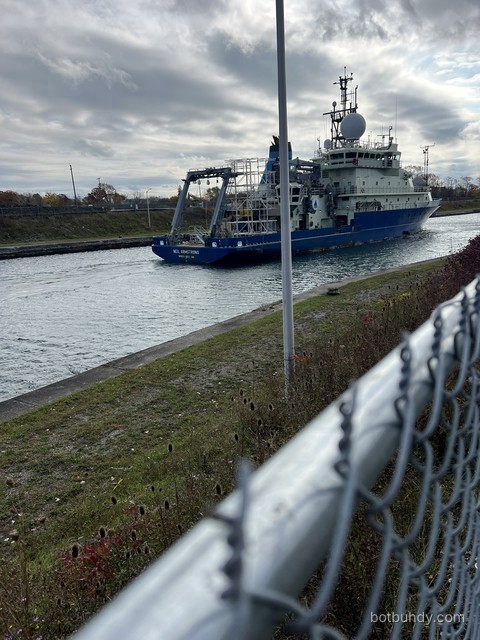
We photographed her on November 5, 2026 from the bike path during that transit. The tall silver structure on the stern looks, at a glance, like it might roll along the seabed collecting samples. It doesn’t. Those are Experimental Neutrino Detector (END) frames — optical Cherenkov detectors that will sit still on the lakebed and watch for tiny flashes of blue light.
Ship at a glance
Dynamic positioning · Stern A-frame 30,000 lb · Allied Systems TK 70-70 knuckle crane · CTD LARS · ROV hangar/LARS · Markey winches · EM124 + EM712 multibeam · SBP29 + Knudsen sub-bottom · ADCPs · Sonardyne USBL · EK80. See everything on board → Specs: WHOI ship specifications.
What’s on board
Every instrument and piece of gear we could actually make out in Brad’s photos and video stills — plus the science suite WHOI says is aboard but that you can’t see from shore (most of it is bolted to the bottom of the hull). Tap a dot, a chip, or a card.
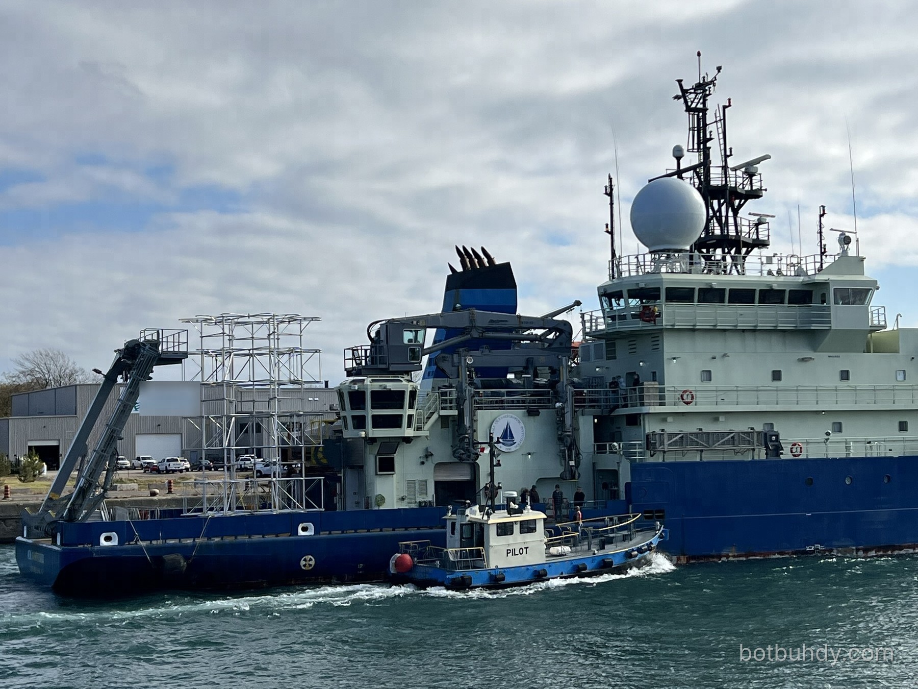 Brad’s photo
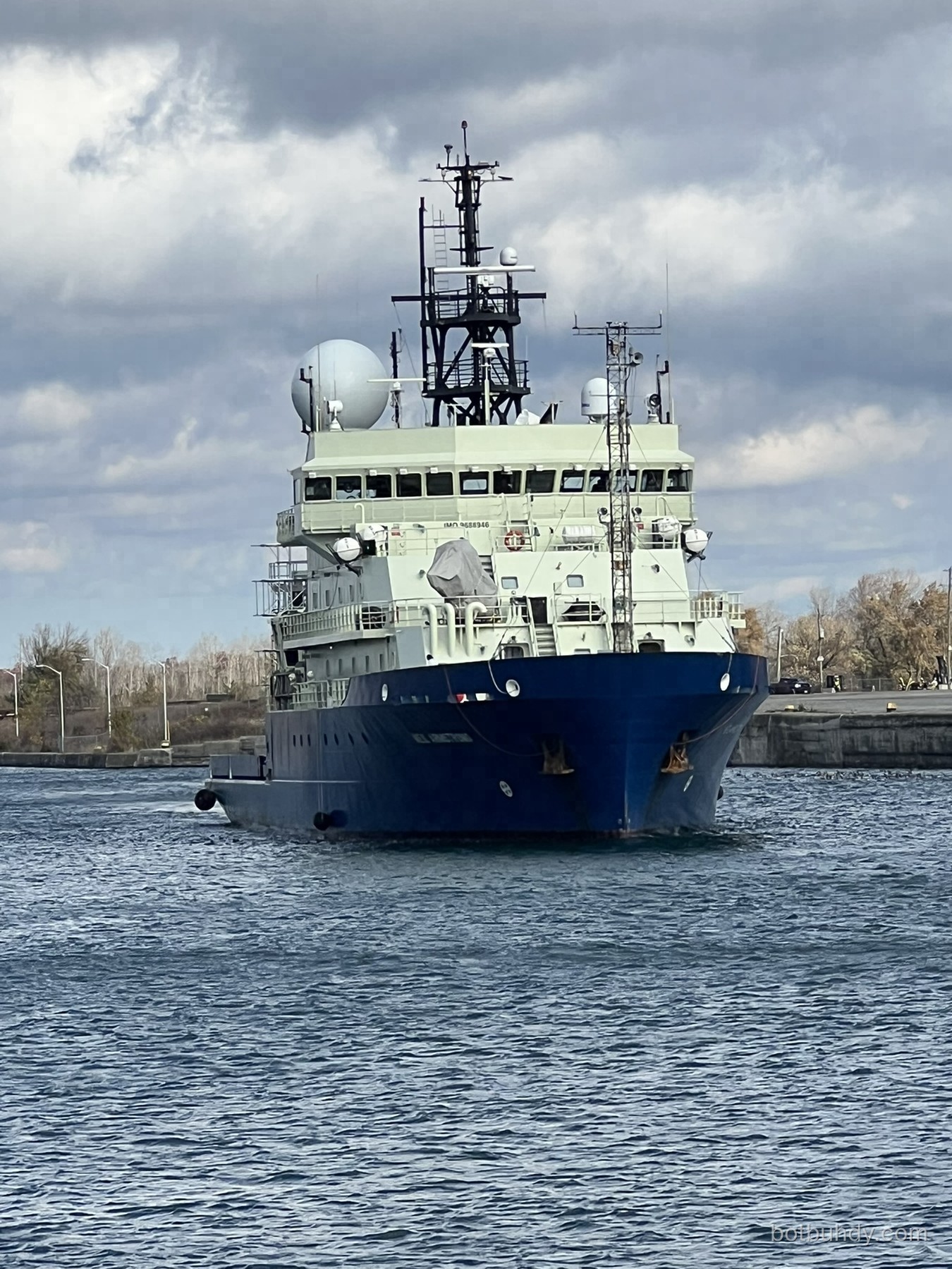 Brad’s photo
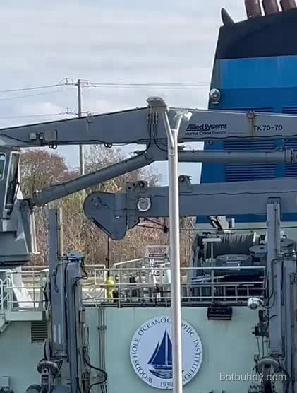 Brad’s video still
 Brad’s video still
Brad’s photo
Instrument directory
Deck & over-the-side handling
Stern A-frame (30,000 lb)Big hydraulic gantry that swings heavy science packages over the stern and back.Visible in Brad’s photos
Rated to about 30,000 lb. It tilts out past the transom so a load hangs clear of the hull, then the winch wire lowers it. This is what will put the END frames on the lakebed. It is a lifting gantry, not a seabed crawler.
Where it lives: Stern, main deck.
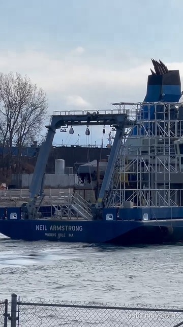
A-frame blocks & gear under the framePulleys (blocks) that guide winch wire over the A-frame, plus deck machinery beneath it.Visible in Brad’s photos
You can see several blocks hanging from the A-frame crossbeam. Wire from the ship’s winches runs up and over these so a package can be lifted straight up and out. The gray machinery under the frame is part of the stern handling setup; we can’t name the exact unit from shore.
Where it lives: Hanging from the A-frame crossbeam; machinery on the stern deck beneath it.
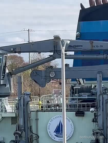
Allied Systems TK 70-70 knuckle-boom craneFolding crane that shifts heavy gear around the working deck and over the side.Visible in Brad’s photos
The lettering on the boom is readable in the video still: “Allied Systems — Marine Crane Division — TK 70-70.” A knuckle boom folds in the middle like a finger, so it can reach far out yet stow compactly. WHOI lists one knuckle crane aboard.
Where it lives: Starboard side, just forward of the working deck.
Crane operator stationSmall railed cab at the crane’s base where an operator runs the boom.Visible in Brad’s photos
A compact cab with a window and a railed platform sits where the crane boom starts. Our read is that this is the crane operator’s station; WHOI doesn’t label it on its public pages, so treat the ID as likely, not confirmed.
Where it lives: Top of the crane pedestal, starboard side.
Confidence: ID likely, not confirmed by WHOI.
Overhanging control cab (white aft cabin)Glass-fronted cabin that hangs over the side so operators can watch over-the-side and stern work.Visible in Brad’s photos
The white, many-windowed cabin overhangs the starboard side and also looks aft over the working deck — from astern it reads as the “white aft control cabin.” From that vantage point an operator can see a package all the way into the water. Exactly which winches and frames are run from here isn’t published on WHOI’s public pages.
Where it lives: Starboard side, aft of the stack, one deck above the working deck.
Confidence: Appears to be one structure seen from two angles.
Stowed hydraulic handling armsFolded hydraulic arms on the hangar wall — over-the-side launch-and-recovery hardware.Visible in Brad’s photos
Two tall, gray hydraulic units flank the WHOI seal, folded upright. WHOI lists a CTD launch-and-recovery system (LARS) and an ROV LARS aboard; these look like part of that over-the-side handling gear, but we can’t confirm which unit is which from the photos.
Where it lives: Starboard hangar wall, either side of the WHOI seal.
Confidence: Visible; exact unit not confirmed.
Winch drum (visible) · Markey winchesBig spool that pays out and hauls in wire or cable for instruments over the side.Visible in Brad’s photos
A cable drum is visible behind the railing in the crane close-up. WHOI lists two Markey CAST-6 hydro winches (24,000 lb, for 0.322" electro-mechanical cable and 3/8" wire) and one Markey DETW-9-11 traction winch (25,000+ lb, for 9/16" wire and 0.680" EM / fiber-optic cable). We can see a drum; we can’t tell which winch it belongs to.
Where it lives: Deck level behind the starboard rail; other winches are inside/under deck.
Confidence: Drum visible; model not identifiable.
Hangar / staging-bay roll-up doorBig roll-up door into the space where instruments are prepped before going over the side.Visible in Brad’s photos
WHOI lists an ROV hangar and a 303 sq ft staging bay. The roll-up door on the starboard side is the kind of opening packages roll through to the deck. Which interior space this particular door serves isn’t labelled publicly.
Where it lives: Starboard side, main deck, under the overhanging cab.
Exhaust stackCarries diesel-generator exhaust up and away from people and sensors.Visible in Brad’s photos
Blue with a black top and four black exhaust pipes. The ship runs four Cummins diesel generators (about 1,044 kW each) that feed electric propulsion motors — the stack vents them high and aft, clear of the forward weather sensors.
Where it lives: Amidships-aft, behind the crane.
CTD launch & recovery system (LARS)Hydraulic arm that swings the CTD rosette out over the side and back without it swinging around.Aboard per WHOI · not visible
WHOI lists a CTD LARS. It may be among the folded arms we can see on the hangar wall, but we can’t confirm that from shore, so it’s marked as WHOI-listed.
Where it lives: Starboard side handling area.
ROV hangar & ROV LARSIndoor space and lifting system for remotely operated vehicles.Aboard per WHOI · not visible
WHOI lists an ROV hangar and an ROV launch-and-recovery system. Visiting vehicles (WHOI’s fleet includes ROV Jason and AUV Sentry) are tracked with the ship’s USBL. Not identifiable in our shots.
Where it lives: Inside the hangar; LARS at the working deck.
Rescue / work boat (RHIB)Small rigid-hull boat for rescue drills and small-boat work.Aboard per WHOI · not visible
WHOI lists one rigid-hull rescue/work boat. We didn’t clearly identify it in Brad’s photos.
Where it lives: Deck stowage with a davit.
Portable lab-van spaceDeck space for up to four 20-ft science vans (portable labs/containers).Aboard per WHOI · not visible
Up to four 20-ft vans can be bolted on deck for a cruise. On this voyage the aft deck is taken up by the END frames instead.
Where it lives: Working deck.
Masts, radar & comms
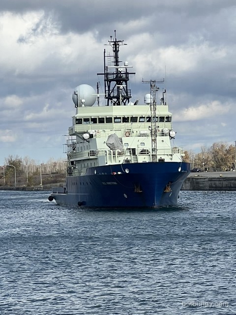
Large satellite radomeBig white dome protecting a tracking satellite antenna — the ship’s internet and data link.Visible in Brad’s photos
The dome keeps a motorised dish dry and pointed at a satellite while the ship rolls. WHOI lists a satellite communication system plus Fleet Broadband, Iridium and Inmarsat-C services; the exact system inside this dome isn’t stated on WHOI’s public pages.
Where it lives: Bridge roof, beside the main mast.
Smaller white domesSmaller antenna housings — likely extra satcom and/or GPS units.Visible in Brad’s photos
You can spot at least two smaller domes on the mast and bridge roof. WHOI lists Fleet Broadband, Iridium and Inmarsat-C services plus GNSS-aided navigation; which antenna is which isn’t published, so these are labelled “likely.”
Where it lives: Main mast platforms and bridge roof.
Confidence: Purpose likely; model not confirmed.
Open-array radar (upper)The long rotating bar that sweeps for other ships, shorelines and buoys.Visible in Brad’s photos
The wide bar near the top of the main mast is a marine navigation radar antenna. It spins to paint a picture of traffic and land for the bridge — essential in narrow lake and river channels.
Where it lives: Upper platform of the main mast.
Second radar scanner (lower)A second, smaller radar antenna for redundancy and a different range/frequency.Visible in Brad’s photos
Ships usually carry two radars on different bands. WHOI also lists an HZG wave radar system, which reads sea-surface wave patterns from marine radar images — we can’t tell from shore which antenna feeds it.
Where it lives: Lower platform of the main mast.
Masthead: nav lights, whips & small sensorsNavigation lights, whip antennas and small sensors at the very top of the mast.Visible in Brad’s photos
The topmost spars carry navigation lights (so other vessels can read the ship’s heading at night), VHF/radio whips and small instruments such as wind sensors. Individual units are too small to name from shore.
Where it lives: Top of the main mast and bridge roof.
Forward lattice mast (MET sensors)Tall lattice mast near the bow that carries the weather sensors.Visible in Brad’s photos
WHOI says the forward mast houses the underway meteorological sensors: two Vaisala WXT weather transmitters (air temperature, pressure, humidity, rain, wind), Eppley PSP and PIR radiometers (short- and long-wave radiation) and a PAR sensor. The mast is clearly visible; the individual sensors are too small to pick out.
Where it lives: Foredeck, ahead of the bridge.
Confidence: Mast visible; sensors not resolvable.
Weather sensors (Vaisala WXT, Eppley PSP/PIR, PAR)Measure wind, air temperature, pressure, humidity, rain and sunlight while underway.Aboard per WHOI · not visible
Logged continuously alongside the ship’s position so scientists know the weather everywhere the ship has been. These sit on the forward mast — too small to see in our photos.
Where it lives: Forward mast.
Bridge, angled windows & bridge wingsThe ship’s command centre, with outward-angled glass and open wings for docking views.Visible in Brad’s photos
The forward-raked windows cut glare; the wings stick out each side so officers can look straight down the hull when docking or in a lock. Navigation, dynamic positioning and radar displays live here.
Where it lives: Top of the forward deckhouse.
SearchlightsPowerful lamps for spotting buoys, lines and people in the water at night.Visible in Brad’s photos
Small barrel-shaped lights on the bridge roof railings.
Where it lives: Bridge roof.
Under the hull · acoustics
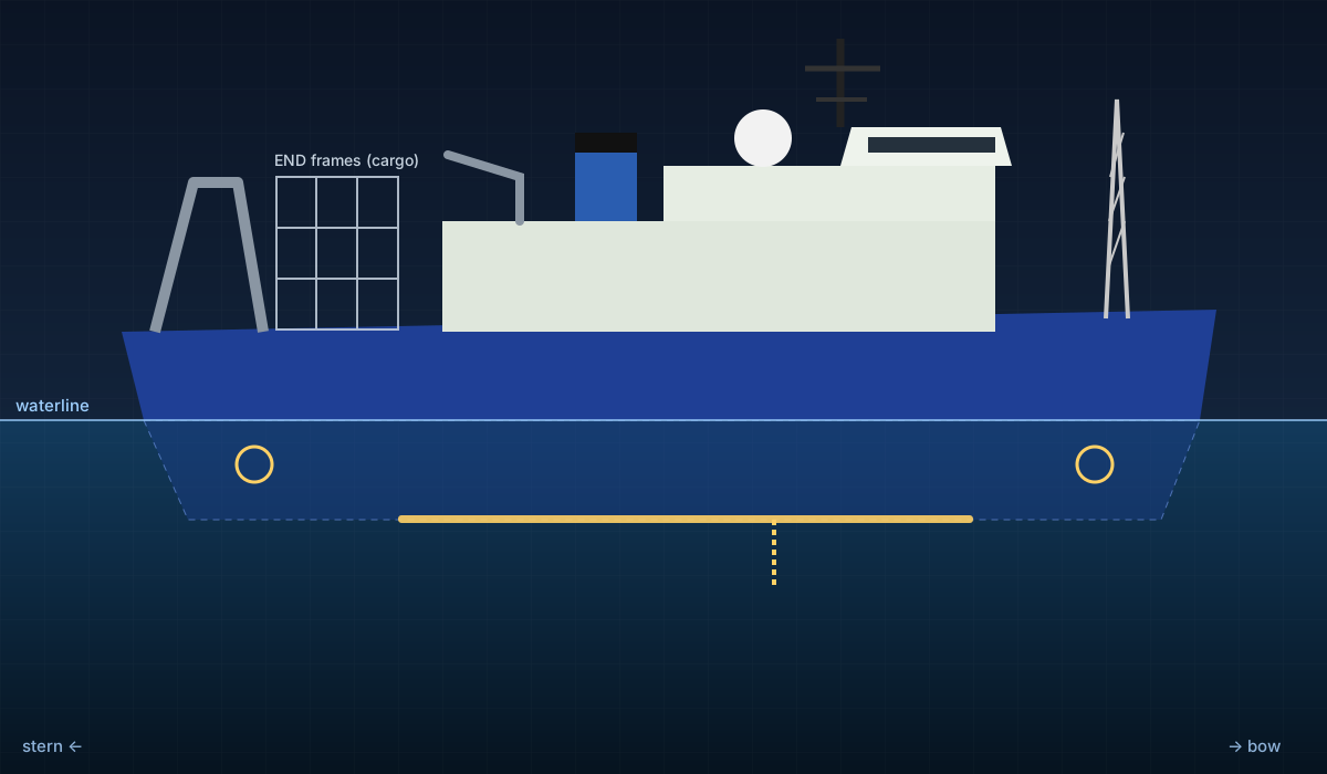
Kongsberg EM124 multibeam (12 kHz)Maps the seafloor in a wide fan of soundings — deep-water bathymetry to full ocean depth.Aboard per WHOI · not visible
Swath 2–6× water depth (about 3.5× in 3–4 km of water), up to 864 soundings per ping in dual-ping mode, records water-column data. Transducer arrays are mounted flush in the hull bottom.
Where it lives: Hull-mounted (below waterline).
Kongsberg EM712 multibeam (40–100 kHz)Higher-resolution seafloor mapping in shallower water (to ~3,600 m).Aboard per WHOI · not visible
Swath about 5.5× depth. Likely the more useful mapper in the Great Lakes, which are shallow by ocean standards.
Where it lives: Hull-mounted (below waterline).
Kongsberg SBP29 sub-bottom profilerLow-frequency sound (2–9 kHz) that penetrates mud to image layers beneath the seafloor.Aboard per WHOI · not visible
“Borrows” the EM124’s transmit/receive arrays; records SEG-Y. Full ocean depth.
Where it lives: Hull-mounted (shares EM124 arrays).
Knudsen 3260 chirp echosounderSimple 3.5 kHz + 12 kHz echosounder for depth and shallow sub-bottom layers.Aboard per WHOI · not visible
Uses a 3.5 kHz array and a 12 kHz transducer; data logged in SEG-Y.
Where it lives: Hull-mounted.
Kongsberg EK80 split-beam echosounderFive frequencies (18–200 kHz) that “see” fish, plankton layers and gas-bubble seeps.Aboard per WHOI · not visible
Detects gas bladders in fish or large animals and bubble plumes rising from the bottom.
Where it lives: Hull-mounted.
ADCPs (38, 150 & 300 kHz)Measure water currents beneath the ship by listening to Doppler-shifted echoes.Aboard per WHOI · not visible
Teledyne RDI Ocean Surveyor 38 kHz (0–1,000 m), OS150 (0–400 m) and Workhorse Mariner 300 kHz (0–200 m).
Where it lives: Hull-mounted.
Sonardyne Ranger 2 USBLAcoustic “GPS” that tracks beacons on the CTD, trawls or vehicles underwater.Aboard per WHOI · not visible
A single transducer on a retractable pole beneath the ship gives range, bearing and depth to portable beacons — the main way the ship tracks gear like the CTD or vehicles such as Jason and Sentry. Handy for placing heavy frames precisely.
Where it lives: Retractable pole through the hull.
K-Sync sonar synchronisationTimes all the sonars’ pings so they don’t drown each other out.Aboard per WHOI · not visible
Kongsberg synchronisation unit that coordinates EM124, EM712, EK80, ADCPs and others.
Where it lives: Inside (electronics room/lab).
Water sampling & labs
CTD rosette (SBE 9plus, 24 × 10 L bottles)Lowered on a cable to profile conductivity (salinity), temperature and depth — and grab water samples.Aboard per WHOI · not visible
SBE 9plus CTD with SBE 32 24-position carousel and 24 ten-litre Niskin bottles. Sensors include dual temperature/conductivity, oxygen (SBE 43), altimeter, chlorophyll/turbidity, 25 cm transmissometer and PAR (to 2,000 m). Stored inside; deployed via the CTD LARS.
Where it lives: Hangar / staging area; goes over the starboard side.
Underway seawater system + TSGPumps surface water to the wet lab so sensors log it continuously along the track.Aboard per WHOI · not visible
SBE 45 thermosalinograph (temperature + salinity), SBE 48 hull-contact temperature sensor (below the waterline, inboard), WETStar fluorometer (chlorophyll & CDOM) and C-Star transmissometers (25 cm and 10 cm).
Where it lives: Intake in the hull; sensors in the wet lab.
pCO₂ system (General Oceanics 8050)Measures dissolved carbon dioxide in surface water to track acidity over time.Aboard per WHOI · not visible
LI-COR LI-7000 infrared CO₂ detector, equilibrator, certified CO₂ standards every 3–6 h, plus above-deck air readings.
Where it lives: Wet lab (fed by the underway system).
XBT launcher (Sippican MK-21)Fires expendable probes that radio back a temperature profile as they sink.Aboard per WHOI · not visible
About one per day; the sound-speed profile feeds the multibeam and USBL so their depth math stays accurate.
Where it lives: Hand-launched from deck; electronics in the lab.
Labs, freezers & clean waterMain lab (1,023 sq ft), wet lab (398), computer lab (311), staging bay (303) and cold storage.Aboard per WHOI · not visible
Two −80 °C freezers (417 L total), two walk-in cold rooms (−15 to 10 °C) and a Milli-Q deionised-water system (~80 gal tank).
Where it lives: Inside the main deckhouse.
Navigation, positioning & propulsion
Kongsberg dynamic positioning (DP)Computer that drives the propellers and thrusters to hold the ship on one spot.Aboard per WHOI · not visible
Crucial for lowering END frames onto an exact patch of lakebed: DP holds position against wind and current while the A-frame does its work.
Where it lives: Bridge consoles; acts through the thrusters.
Seapath 380 + POS/MV positioningGPS combined with motion sensors — exact position, heading, roll and pitch for every sonar ping.Aboard per WHOI · not visible
Kongsberg Seapath 380 GNSS-aided inertial navigation and an Applanix POS/MV precision GPS. Their GPS antennas sit up high (probably among the small mast domes/antennas); the motion units are inside.
Where it lives: Antennas on the mast; units inside.
HZG wave radar systemTurns marine-radar images of the sea surface into wave height and direction.Aboard per WHOI · not visible
Uses radar backscatter from the waves; we can’t tell from shore which radar antenna feeds it.
Where it lives: Radar antenna on the mast; processing inside.
Thruster warning marks (bow & stern thrusters)Hull symbol warning small boats that a sideways thruster can blast water here.Visible in Brad’s photos
The circle-with-cross symbol painted on the hull marks a thruster tunnel underneath. WHOI lists a White-Gill bow thruster (686 kW) and a Schottel stern thruster (620 kW); with two Siemens 876 kW propulsion motors they let the ship move sideways and hold station. The symbols are visible; the thrusters are underwater.
Where it lives: Hull near bow and stern, below the marks.
Confidence: Marks visible; thrusters underwater.
Markings & safety gear
WHOI sealWoods Hole Oceanographic Institution, which operates the ship.Visible in Brad’s photos
The ship is owned by the U.S. Navy (Office of Naval Research) and operated by WHOI for the U.S. academic research fleet.
Where it lives: Starboard hangar wall.
IMO 9688946 letteringThe ship’s permanent international ID number — like a VIN for vessels.Visible in Brad’s photos
Painted on the front of the bridge deck. Call sign WARL.
Where it lives: Front of the bridge deck.
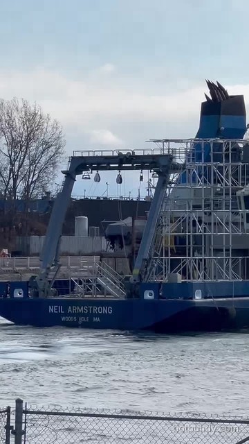
Bow name & stern letteringNEIL ARMSTRONG on the bow; NEIL ARMSTRONG / WOODS HOLE MA (home port) on the stern.Visible in Brad’s photos
Required name and home-port markings, visible in both photos and video stills.
Where it lives: Bow flare and transom.
Anchors & hawse pipesAnchors stowed in hull openings, ready to drop.Visible in Brad’s photos
Two anchors sit snug in their hawse pipes either side of the bow.
Where it lives: Bow, port and starboard.
Tarp-covered foredeck equipmentSomething under a gray cover on the foredeck — not identifiable from shore.Visible in Brad’s photos
We can see a covered object ahead of the bridge. It could be mooring machinery or stowed gear; we’re not guessing beyond that.
Where it lives: Foredeck.
Confidence: Unidentified.
Liferaft canistersWhite capsules holding inflatable liferafts that pop open in an emergency.Visible in Brad’s photos
Standard SOLAS safety gear, mounted at the sides of the upper decks.
Where it lives: Bridge-deck sides.
Confidence: ID likely (standard shape).
Life rings, stairs & railingsThrowable life rings and guarded stairs/rails around the working decks.Visible in Brad’s photos
Orange-and-white life rings hang on the rails; stairways and railings surround the A-frame deck.
Where it lives: All decks.
Mooring chocksOval openings in the bulwark that guide mooring lines without chafing.Visible in Brad’s photos
Visible along the stern bulwark; lines pass through them to bollards on deck.
Where it lives: Stern bulwark.
Cargo & context (not permanent ship gear)
END detector frames (voyage cargo)Five tall silver frames of the Experimental Neutrino Detector — headed for the Lake Superior lakebed.Voyage cargo · temporary
Not a permanent ship sensor. WHOI’s mooring-ops team built five frames (~30 ft tall, ~8,000 lb each with gear) carrying Digital Optical Modules that watch for faint blue Cherenkov flashes. The A-frame lowers them; fiber-optic cables run to shore. Once the job is done, the deck goes back to normal.
Where it lives: Aft working deck, under and ahead of the A-frame.
Pilot boatLocal pilot vessel riding alongside for the inland transit — not part of the ship.Not ship gear
Ocean ships take a licensed pilot through locks and narrow channels.
Where it lives: Alongside, starboard.
Yellow/blue “01” unit (lock wall)Correction: this is shore equipment on the lock wall, not ship gear.Not ship gear
Earlier we listed the yellow/blue enclosure marked “01” as aft-deck gear. A closer look at the video still shows it sits on the concrete lock wall and carries a Cavotec label — an automated mooring unit used to hold ships in the lock. It isn’t part of Neil Armstrong.
Where it lives: Lock wall (shore side).
Photos and video stills © BotBuhdy (Brad), Nov 5, 2026, from the bike path. The “Hidden gear” diagram is a simplified BotBuhdy illustration — not a WHOI drawing — and positions are approximate. Equipment facts: WHOI Science & Ship Equipment and WHOI Specifications, checked Nov 5, 2026. Items marked “likely” are our best read from shore.
How END works
The Experimental Neutrino Detector (END) is led by the University of Minnesota Duluth, sponsored by DARPA, with cooperation from DOE’s Office of Science, Fermilab and Brookhaven National Lab. WHOI’s Mooring Operations and Engineering group built five detector frames. Neil Armstrong will lower them onto the lakebed near Two Harbors, Minnesota, and run fiber-optic cables to shore.
On deck — five END frames ride aft under the A-frame
Neutrinos, in one breath
Neutrinos are tiny particles that almost never bump into anything — trillions pass through you every second. When one does interact in the water, it can make a charged particle that outruns light in that water, leaving a faint blue cone of Cherenkov light. The beach-ball-sized Digital Optical Modules (DOMs) catch those flashes so physicists can study the particle.
Sources: WHOI press release, Oct 28, 2026. Animation is a simplified BotBuhdy illustration, not a WHOI engineering drawing.
The voyage
Photo gallery
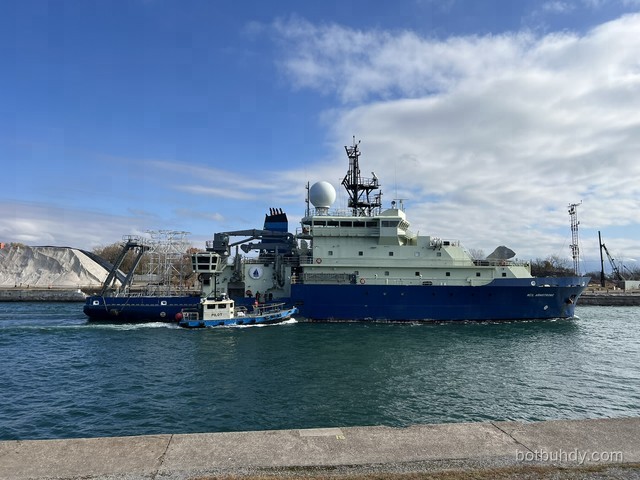
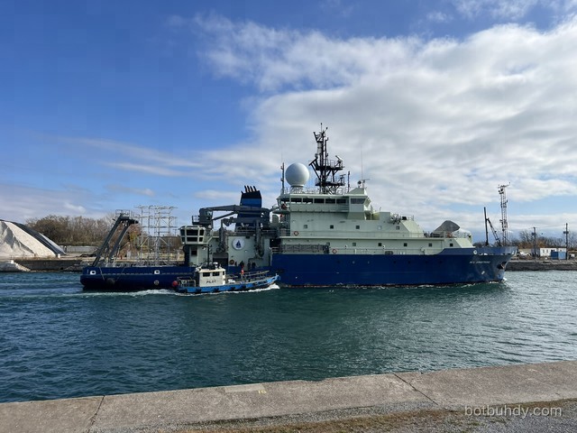
Tap any photo to open it large. All shots © BotBuhdy, Nov 5, 2026, from the bike path.
Videos
Sources
- WHOI — “WHOI Research Vessel Neil Armstrong to make first-ever voyage through the Great Lakes” (Oct 28, 2026).
- WHOI — R/V Neil Armstrong.
- WHOI — Neil Armstrong specifications.
- WHOI — Science & ship equipment (instrument directory source).
- WHOI — Neil Armstrong ship tracker.
BotBuhdy is not affiliated with WHOI, the U.S. Navy, UMD, DARPA, DOE, Fermilab or BNL. Photos are ours; ship and mission facts are from the public WHOI sources above.